The First Sunrise | Anini & Kibithoo
- North-East India
Durations
12 Days
Difficulty
Challenging, Moderate
Enjoy the Adventure
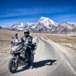
The journey begins in Dibrugarh and heads into the Lower Dibang Valley, reaching Roing and then the remote outpost of Anini. Travelers explore the pristine high-altitude landscapes, interact with the Idu Mishmi tribe, and experience the region’s rugged beauty, with rest and buffer days built in to accommodate challenging road conditions.
The expedition continues east to the Lohit Valley, visiting Kibithoo and Kaho on the Line of Actual Control, where participants experience frontier life and witness India’s first sunrise from Dong Valley. The return route takes the group south through Parshuram Kund and Tezu before concluding in Dibrugarh, completing a circuit of Arunachal Pradesh’s most remote and scenic regions.


Day-to-Day Itinerary
We have carefully planned out each day to give you the best possible experience. From exploring historic landmarks to tasting delicious local cuisine, each day is packed with adventure and excitement. Join us as we take you on a journey through some of the most fascinating destinations in the world.

Arrival Airport: Mohanbari Airport, Dibrugarh (DIB)
Focus: Vehicle checks, permit verification, and expedition briefing
Permit Note: Inner Line Permits (ILP/PAP) for Arunachal Pradesh are mandatory and must be secured in advance
Arrive in Dibrugarh, the operational base for expeditions into Eastern Arunachal. The day is dedicated to final preparations, including a thorough check of 4×4 vehicles and verifying all travel permits. The team briefing will cover the challenging road conditions and remote nature of the journey.
Night Stay: Dibrugarh
Distance Covered: ~120 km
Time Taken: 4-5 hours
Terrain: Plains, crossing the Bhupen Hazarika Setu (Dhola-Sadiya Bridge)
Begin the expedition by crossing the Bhupen Hazarika Setu, India’s longest bridge, over the Lohit River. The drive enters Arunachal Pradesh and continues across the plains to Roing, the headquarters of the Lower Dibang Valley and the last major town before the ascent to Anini.
Night Stay: Roing
Distance Covered: ~235 km
Time Taken: 10-14 hours
Terrain: Extremely challenging and remote mountain roads, prone to landslides
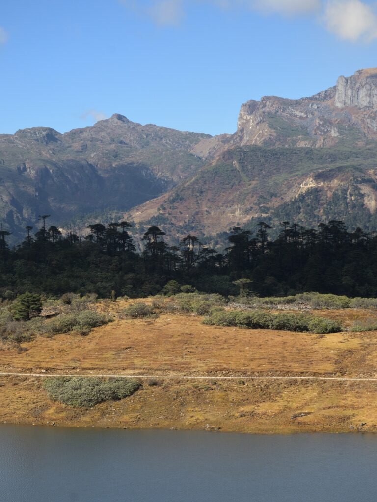
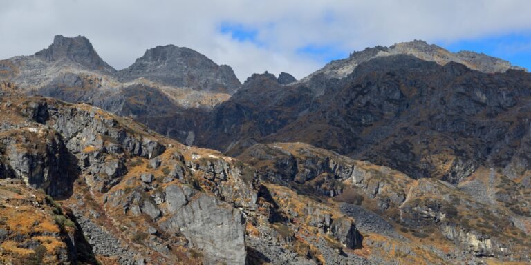
A long and arduous day of expedition driving. The route from Roing to Anini is one of the most challenging in the state, climbing steadily along the roaring Dibang River. The landscape becomes progressively wilder and more remote. Arrive in Anini, a small, isolated outpost near the Tibetan plateau.
Night Stay: Anini – Altitude: ~1,968m / 6,456 ft
Focus: Exploring the town and its immediate high-altitude surroundings
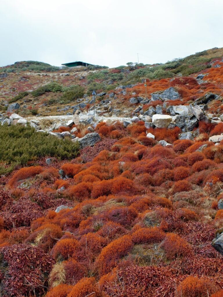
Spend the day exploring the unique environment of Anini, one of India’s most remote district headquarters. The area is home to the Idu Mishmi tribe. Visit local villages and enjoy the stunning views of pristine, untouched landscapes.
Night Stay: Anini
Focus: A necessary day for rest and to account for potential road-related delays
A designated rest and contingency day. The extreme remoteness and unpredictable road conditions of the Dibang Valley make a buffer day essential. Use the day to relax, acclimatize, or undertake short local walks.
Night Stay: Anini
Distance Covered: ~235 km
Time Taken: 10-14 hours
Begin the long journey back, descending from the high mountains of the Dibang Valley to the relative plains of Roing. This is another full day of challenging driving, offering different perspectives of the wild and beautiful valley.
Night Stay: Roing
Distance Covered: ~270 km
Time Taken: 10-12 hours
Terrain: Difficult mountain roads along the Lohit River gorge
Drive east from Roing, crossing into the Lohit district. The route passes through Tezu, Hayuliang, and Walong, following the Lohit River into a deep gorge. Arrive in Kibithoo, one of India’s easternmost motorable villages, located directly on the Line of Actual Control (LAC) with China.
Night Stay: Kibithoo/Kaho
Focus: Exploring India’s easternmost villages and strategic viewpoints
Explore Kibithoo and the nearby village of Kaho, officially recognized as India’s ‘First Village’ from the east. Interact with the Meyor tribe and army personnel (subject to permissions). The area offers a direct sense of life on a sensitive international border.
Night Stay: Kibithoo/Kaho
Activity: A pre-dawn trek of approx. 1.5–2 hours one-way
Focus: A unique astronomical and geographical experience
Embark on a pre-dawn trek to a viewpoint in the Dong Valley, strategically located to be among the first people in India to witness the sunrise. This is a significant highlight of the trip. Return to the village for breakfast and rest for the remainder of the day.
Night Stay: Kibithoo/Kaho
Distance Covered: ~200 km
Time Taken: 7-9 hours
Begin the journey back from the frontier. Descend along the Lohit River, leaving the high border region behind. The destination is Parshuram Kund, a significant Hindu pilgrimage site on the banks of the river, surrounded by dense forests.
Night Stay: Parshuram Kund/Tezu
Distance Covered: ~160 km
Time Taken: 5-6 hours
Complete the final leg of the drive, leaving the hills of Arunachal Pradesh for the last time and returning to the plains of Assam. Arrive in Dibrugarh and conclude the expedition with a final dinner.
Night Stay: Dibrugarh
- Departure Airport: Mohanbari Airport, Dibrugarh (DIB)
After breakfast, transfer to the Dibrugarh airport for your flight home, concluding the expedition to India’s easternmost frontiers.
Inclusions
We plan for all stays and meals. We arrange, if required, for accomodation on a twin-sharing or single basis, Inner Line Permits and associated fees, a basic First Aid Kit for fixed departures, certified guides and instructors including NOLS-certified guides, mechanic support throughout the trip.
Exclusions
5% GST, personal expenses, insurance, fines or servicing costs, activities additional to what has been planned for, extra costs arising from delays or breakdowns, and anything not specifically included as per customized final plan.